
SEOUL · GETTING AROUND
From Gyeongbokgung to Seoul Forest: Your First Subway Transfer
Maya changes once, from Line 3 to Line 2, and picks her direction by the name of the next station rather than the last
The subway transfer piece of “Getting Around Seoul.” From Gyeongbokgung on Line 3, Euljiro 3(sam)-ga is the third stop. Change there to Line 2, head towards Euljiro 4(sa)-ga, and Ttukseom is the seventh stop. You choose the direction by the next station’s name, and you tap your card when you board and when you get off. Maya, who first picked Seoul from screens, walks the transfer that a screen passes over in a single cut.

How to get there
A map app’s walking route (TMAP) calculated from Exit 8 of Ttukseom Station on Line 2 to Seoul Forest’s map reference point. The Seoul Metropolitan Government’s parks page gives about 10 minutes on foot from Exit 8 (a different reference point).
This is the subway transfer piece of “Getting Around Seoul” — third in the issue’s running order, and the third to go out. Lulu chose a first transit card for her friend who is coming to Seoul next month, and Elena rode the first train that friend will take, from the airport to Seoul Station. Next comes the friend’s first change of line in the city. Maya rides it first.
Maya picked Seoul from screens before she ever walked it. She keeps a list of scenes from dramas and videos, then goes to each place on foot and chooses again. On that list, changing trains is always a single cut. Doors close on one platform, and in the next shot the character is already sitting on another train. What lies in between, the screen has never shown her.
The friend’s plan has Gyeongbokgung in the morning and Seoul Forest in the afternoon. The route Maya picks from the subway map runs along Line 3 and changes once, at Euljiro 3(sam)-ga, to Line 2. On a weekday afternoon, heading down into Gyeongbokgung Station on Line 3, she writes on the first line of her notebook: “As of 1 October 2026. One transfer.” Every fare and rule in this piece was checked on that date.
Gyeongbokgung: tap once on the way in
The basic fare covers the first 10 km; from 10 to 50 km another ₩100 is added every 5 km, and beyond 50 km another ₩100 every 8 km.
Maya holds her stored-value transit card to the reader on the ticket gate. A short beep, and the flaps open. On screen, even that sound would be cut. Find on a map

On Maya’s list, ticket-gate scenes usually involve running — a train about to close its doors, a hand gripping a bag strap. Today she doesn’t run. Someone riding for the first time needs the order of things more than speed, she thinks. Her friend will probably walk this way slowly the first time too.
The subway fare is set by distance: the basic fare covers the first 10 km, ₩100 is added every 5 km from 10 to 50 km, and ₩100 every 8 km beyond 50 km. To calculate the distance, you must tap your card both when boarding and when getting off. So this tap only marks the starting point. The price of the journey is settled when she gets off.
Instead of a fare, Maya writes down an order: “Tap at Gyeongbokgung, tap at Ttukseom.” What lies in between, she will see at Euljiro 3(sam)-ga.
The side where the next stop is Anguk
The basic subway fare in the capital area is ₩1,550 with a transit card and ₩1,650 with a single-journey ticket bought with cash (from the first train on 28 June 2025).
Down on the platform, full-height glass screen doors close off the track. Maya first decides which train to board. For Euljiro 3(sam)-ga, she wants the side where the next stop is Anguk. Find on a map

There’s no need to memorise the name of the last station on the line. All Maya needs is the next one. From Gyeongbokgung, past Anguk and Jongno 3(sam)-ga, the third stop is Euljiro 3(sam)-ga.
While she waits, she notes the basic fare. From the first train on 28 June 2025 the basic subway fare in the capital area is ₩1,550 with a transit card and ₩1,650 for a single-journey ticket bought with cash.
The train pulls in, and the glass doors and the train doors open together. Maya stands by the door, holding the grab pole. On the screen above the door, the next station’s name changes — Anguk, then Jongno 3(sam)-ga. As the doors open and close at two intermediate stops, she thinks of the scenes on her list. None of them had these three stops.

Euljiro 3(sam)-ga: the corridor the screen skips
Under the capital area’s integrated transfer discount, you use one card per person and board the next mode within 30 minutes of getting off (60 minutes between 9 pm and 7 am); it covers up to four transfers (five rides). Changing to the same route or the same vehicle does not count.
At Euljiro 3(sam)-ga, Maya gets off, finds the transfer signs for Line 2 and follows them. Find on a map

As she walks, she watches the people more than the way itself — those heading the same way, those coming towards her, someone stopping for a moment at a sign. On the screens on her list, all of them were cut, and the character simply stood on the next platform.

Each time a sign comes into view again, Maya checks it and walks on. On screen, these small checks are cut out entirely. For a friend arriving for the first time, those few checks may be most of what a transfer is.
Among the people in the corridor are travellers with big bags and others walking fast with earphones in. Maya slows to the pace her friend might keep. Someone here for the first time would probably take out a phone about now. That’s fine, Maya notes in the corner of a page.
There’s one rule that is easy to confuse. The capital area’s integrated transfer discount applies when you use one card per person and board another mode of transport within 30 minutes of getting off (60 minutes between 9 pm and 7 am), for up to four transfers, which means five rides. Changing to the same route or the same vehicle does not count. Those 30 minutes run from getting off one mode to boarding the next. Maya doesn’t look at the clock in the corridor.
Direction: not the last station, the next one
On Line 3, Euljiro 3(sam)-ga is the third stop from Gyeongbokgung, after Anguk and Jongno 3(sam)-ga. Change there to Line 2 and head in the direction of Euljiro 4(sa)-ga: after Dongdaemun History & Culture Park, Sindang, Sangwangsimni, Wangsimni and Hanyang Univ., Ttukseom is the seventh stop.
Before she reaches the Line 2 platform, Maya stops for the first time. A character on screen wouldn’t hesitate here. What she has to choose is the direction. Find on a map
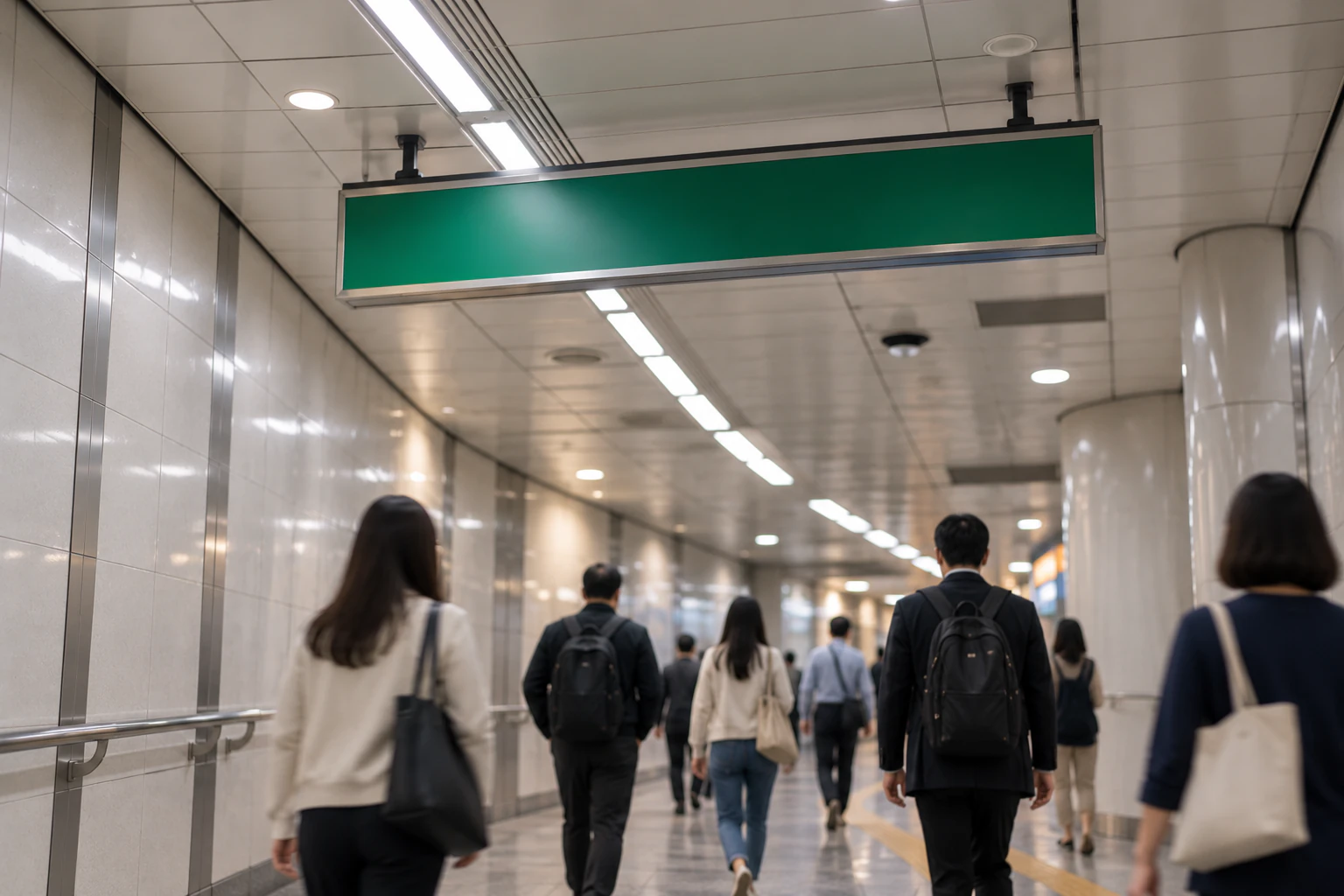
In front of the signs, a few people look at maps on their phones and a few look up and read. Those who know the station walk straight past. She is tempted to follow them, but she has no idea where they are going.

The main loop of Line 2 is 48.8 km long; inner-loop trains run clockwise and outer-loop trains anticlockwise. On this route, check that the next station is Euljiro 4(sa)-ga to pick your direction. In that direction, Ttukseom is the seventh stop, after Dongdaemun History & Culture Park, Sindang, Sangwangsimni, Wangsimni and Hanyang Univ.
Maya finds the name Euljiro 4(sa)-ga and reads it aloud once. In her notebook she writes: “Not the last station. The next one.” Then she heads for the platform that name points to.
Seven stops, counting the next station’s name
Since the first trains on 7 March 2026, across all 13 urban-rail operators in the capital area, if you leave without tapping out with a pre- or post-paid transit card, the basic fare (₩1,550 for adults) is added the next time you board. Season tickets, single-journey tickets and concession passes are excluded.
The Line 2 platform has full-height glass doors too. A train pulls in. This time she stands by the door and counts the stops: Euljiro 4(sa)-ga, Dongdaemun History & Culture Park, Sindang, Sangwangsimni, Wangsimni, Hanyang Univ. The doors open at six intermediate stops. Find on a map

As the stops go by, Maya looks from her own reflection in the window to the screen above the door and back. Subway scenes on her list rarely lasted even one stop. A scene that rode all seven wasn’t on the list.
Just before Ttukseom, she checks the screen above the door once more. The seventh station’s name is up. Euljiro 4(sa)-ga, the name she read aloud when choosing her direction, was the name of the direction that brought her all the way here. Maya steps off.
At the exit gates, she taps her card again — marking the end point the distance is counted to. Since the first trains on 7 March 2026, across all 13 urban-rail operators in the capital area, if you leave without tapping out with a pre- or post-paid transit card, the basic fare (₩1,550 for adults) is added the next time you board. Season tickets, single-journey tickets and concession passes are excluded.
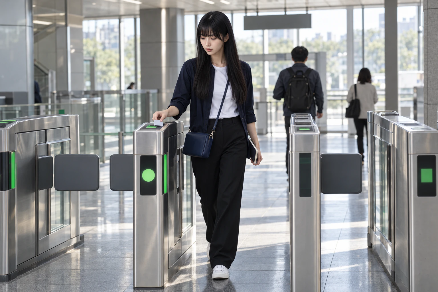
The reader gives a short beep, the same one she heard at Gyeongbokgung. Once going in, once coming out. The order in her notebook ends here.
Beside the order in her notebook, Maya draws two small ticks — one for Gyeongbokgung, one for Ttukseom. Two ticks and a few station names in between should be enough for her friend, she thinks. The character on screen reached the destination without a single tap, but her friend will have to do these two herself.
Exit 8: about 10 minutes
Seoul Forest is about 2 minutes on foot from Exit 4 of Seoul Forest Station (Suin–Bundang Line) and about 10 minutes from Exit 8 of Ttukseom Station (Line 2).
Past the gates, she chooses an exit. Seoul Forest is about 10 minutes on foot from Exit 8 of Ttukseom Station on Line 2, and about 2 minutes from Exit 4 of Seoul Forest Station on the Suin–Bundang Line. Find on a map
Seoul Forest Station is on the Suin–Bundang Line. This piece settled on a single transfer, so the friend’s way out is Exit 8 at Ttukseom on Line 2. Take a different exit number and you come out on a different street, even at the same station. Maya writes a large “8” in her notebook and circles it.
Out of Exit 8, it is a daylight street. Weekday-afternoon traffic flows along the road, and Maya stops outside the exit for a moment to get her bearings. In the scenes on her list, stepping out of a station meant you were already at your destination. Here there is still a walk to go.

On the pavement outside the exit, Maya turns a page in her notebook. The subway part of the order ends here, and the walking part begins. On screen, the next shot would already be in the middle of the park, but Maya decides to walk the way in between.
Seventeen minutes and ten: two reference points
From Exit 8 of Ttukseom Station (Line 2) to Seoul Forest (its map reference point), the map route is 1,296 m, about 17 minutes (TMAP pedestrian route calculation).
Maya opens a map app. By the map app’s pedestrian route, it is 1,296 m, about 17 minutes, from Exit 8 of Ttukseom Station on Line 2 to Seoul Forest’s map reference point. That is roughly seven minutes more than the “about 10 minutes” above. Find on a map
The two figures use different reference points. So Maya doesn’t pick one. She writes both down, each with its own reference point: “Exit 8 to the park, about 10 min. Exit 8 to the map reference point, 1,296 m, 17 min.”
Walking on, she sees the tops of trees between the buildings first. Then a broad path opens up, and beyond the lawns tall trees stand in early-autumn colour. Above the trees, the city’s tower blocks rise. An afternoon that began underground ends under a wide sky, and Maya adds that to the bottom line of her list.
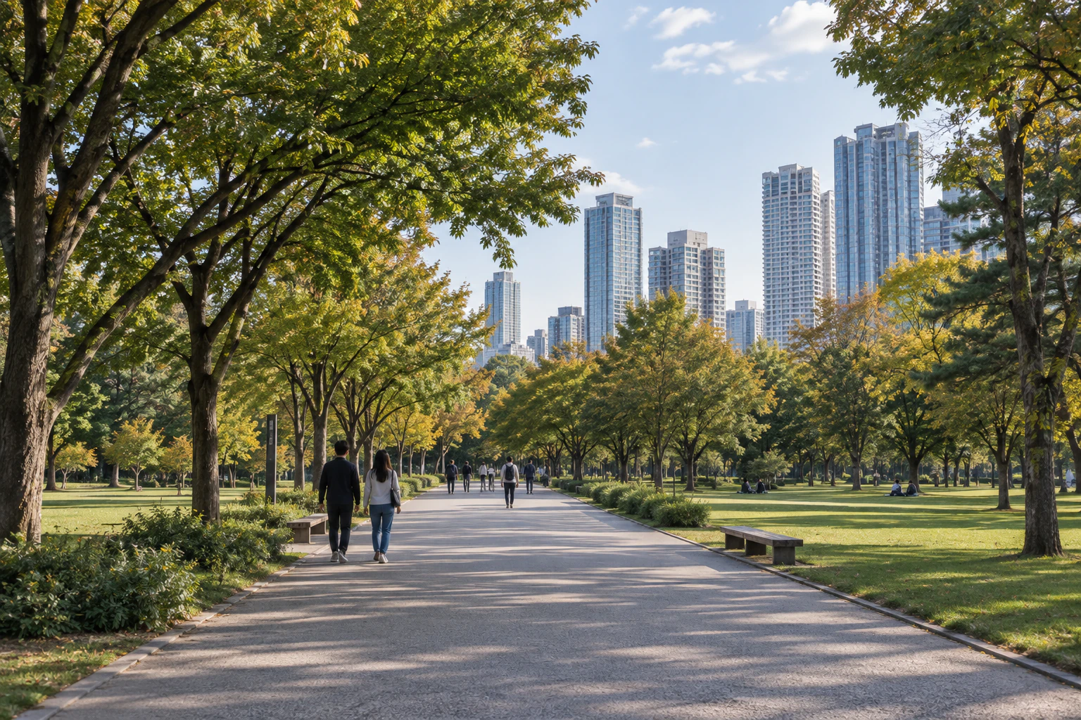
She sits down on a bench and rewrites the day’s list. The inside of Seoul Forest is a walk Rina made separately, in the Han River issue. Today Maya’s route ends here, at the edge of the park’s broad path.
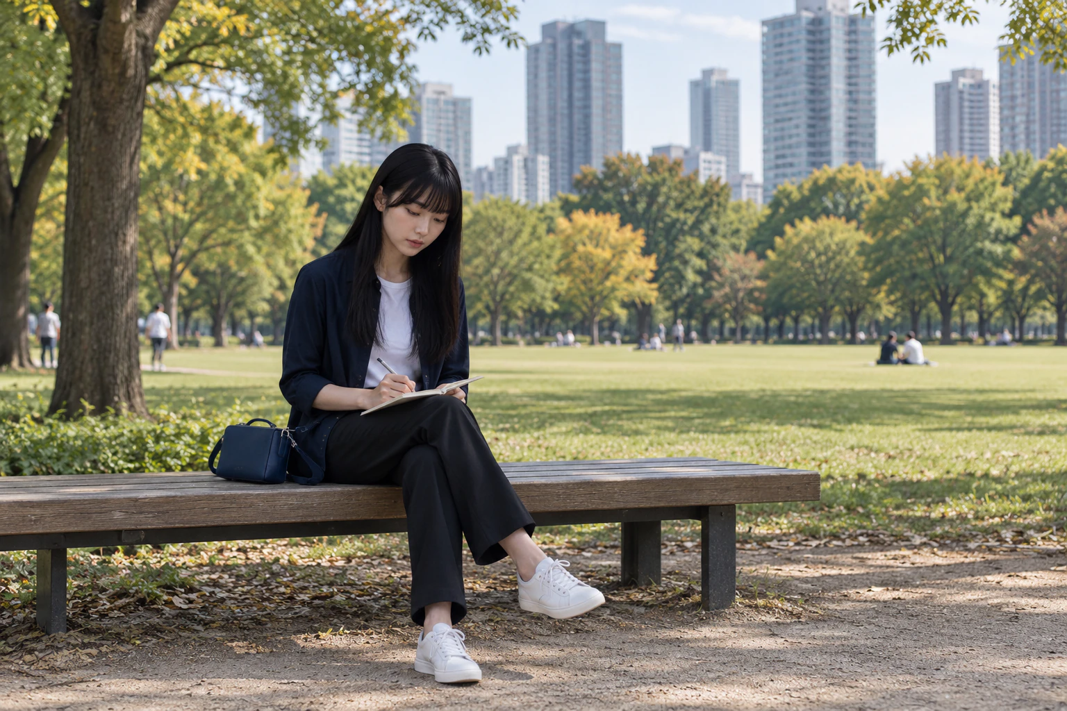
On the bench, Maya writes the note for her friend. “At Gyeongbokgung, take Line 3 from the side where the next stop is Anguk. Get off at the third stop, Euljiro 3(sam)-ga. At Euljiro 3(sam)-ga, follow the transfer signs for Line 2. On Line 2, look for the next station’s name, not the last one — you want Euljiro 4(sa)-ga. Ttukseom is the seventh stop from there. Tap your card once going in and once coming out. If you don’t tap out, the basic fare gets added next time you ride. At Ttukseom, use Exit 8. It is about 10 minutes from there, and the map app calculates 1,296 m, 17 minutes, to Seoul Forest’s map reference point.”
Under the note she adds one line. The fare depends on distance, so she notes the rule: the basic fare up to 10 km, ₩100 more every 5 km from 10 to 50 km, and ₩100 every 8 km beyond 50 km. A transfer that was one cut on screen becomes, in this piece, a sequence of platform, transfer corridor and direction choice. How to choose a card is in Lulu’s transit-card piece, and the way from the airport to Seoul Station is in Elena’s airport piece, both already out. Taking the bus and getting back to your room at night follow in the next pieces of this issue.

(※ This article includes staged images created with AI.)
Try it on your own first transfer
An editorial suggestion: at Gyeongbokgung on Line 3, board on the side where the next stop is Anguk and get off at the third stop, Euljiro 3(sam)-ga. Change to Line 2 towards Euljiro 4(sa)-ga, get off at the seventh stop, Ttukseom, and leave by Exit 8 to walk to Seoul Forest. Choose your direction by the next station’s name rather than the last station on the line.
A diagram of the order only · not to scale, orientation or the actual shape of the streets.
- Board Line 3 at Gyeongbokgung — Tap your card at the gate and board on the platform side where the next stop is Anguk. After Anguk and Jongno 3(sam)-ga, the third stop is Euljiro 3(sam)-ga. Find on a map
- Change to Line 2 at Euljiro 3(sam)-ga — Follow the transfer signs for Line 2. Find on a map
- Towards Euljiro 4(sa)-ga, to Ttukseom — Check your direction by the next station’s name, Euljiro 4(sa)-ga. After Euljiro 4(sa)-ga, Dongdaemun History & Culture Park, Sindang, Sangwangsimni, Wangsimni and Hanyang Univ., the seventh stop is Ttukseom. Tap your card on the way out too. Find on a map
- From Exit 8 of Ttukseom to Seoul Forest — About 10 min on foot from Exit 8. TMAP calculates 1,296 m, 17 min, from Exit 8 to Seoul Forest’s map reference point. Find on a map
Good to know
Checked 2026.10.01
Under the capital area’s integrated transfer discount, you use one card per person and board the next mode within 30 minutes of getting off (60 minutes between 9 pm and 7 am); it covers up to four transfers (five rides). Changing to the same route or the same vehicle does not count.
Checked 2026.10.01
Since the first trains on 7 March 2026, across all 13 urban-rail operators in the capital area, if you leave without tapping out with a pre- or post-paid transit card, the basic fare (₩1,550 for adults) is added the next time you board. Season tickets, single-journey tickets and concession passes are excluded.
Background6
Checked 2026.10.01
The basic fare covers the first 10 km; from 10 to 50 km another ₩100 is added every 5 km, and beyond 50 km another ₩100 every 8 km.
Checked 2026.10.01
The basic subway fare in the capital area is ₩1,550 with a transit card and ₩1,650 with a single-journey ticket bought with cash (from the first train on 28 June 2025).
Checked 2026.10.01
On Line 3, Euljiro 3(sam)-ga is the third stop from Gyeongbokgung, after Anguk and Jongno 3(sam)-ga. Change there to Line 2 and head in the direction of Euljiro 4(sa)-ga: after Dongdaemun History & Culture Park, Sindang, Sangwangsimni, Wangsimni and Hanyang Univ., Ttukseom is the seventh stop.
Checked 2026.10.01
Subway Line 2 is a loop line circling central Seoul; the loop is 48.8 km long. Inner-loop trains run clockwise and outer-loop trains anticlockwise (Seoul Metropolitan Government, 2017).
Checked 2026.09.29
Seoul Forest is about 2 minutes on foot from Exit 4 of Seoul Forest Station (Suin–Bundang Line) and about 10 minutes from Exit 8 of Ttukseom Station (Line 2).
TMAPChecked 2026.10.01
From Exit 8 of Ttukseom Station (Line 2) to Seoul Forest (its map reference point), the map route is 1,296 m, about 17 minutes (TMAP pedestrian route calculation).
- The subway fare covers the first 10 km at the basic fare, adds ₩100 every 5 km from 10 to 50 km, and ₩100 every 8 km beyond 50 km. To calculate the distance you must tap your card both when boarding and when getting off (Seoul Metropolitan Government).
- From the first train on 28 June 2025 the basic subway fare in the capital area is ₩1,550 with a transit card and ₩1,650 for a single-journey ticket bought with cash.
- The capital area’s integrated transfer discount applies when you use one card per person and board another mode of transport within 30 minutes of getting off (60 minutes between 9 pm and 7 am), for up to four transfers (five rides). Changing to the same route or the same vehicle does not count (Seoul Metropolitan Government).
- The main loop of Line 2 is 48.8 km long; inner-loop trains run clockwise and outer-loop trains anticlockwise. Check the direction by the next station’s name (Euljiro 4(sa)-ga).
- Since the first trains on 7 March 2026, across all 13 urban-rail operators in the capital area, if you leave without tapping out with a pre- or post-paid transit card, the basic fare (₩1,550 for adults) is added the next time you board. Season tickets, single-journey tickets and concession passes are excluded (Seoul Metropolitan Government).
- Seoul Metropolitan Government parks page: about 10 min on foot from Exit 8 of Ttukseom Station (Line 2), about 2 min on foot from Exit 4 of Seoul Forest Station (Suin–Bundang Line). TMAP’s pedestrian route calculation (Exit 8 → Seoul Forest’s map reference point) gives 1,296 m, 17 min (a different reference point).
- The figures in this piece were checked on 1 October 2026 (the parks page on 29 September 2026, the TMAP walking calculation on 1 October 2026).
More from this area

From Myeongdong Cathedral to the Journey Back After the Last Train
The last piece of “Getting Around Seoul.” Seoul’s Owl Buses — city buses that run only at night — operate 140 vehicles on 14 routes from 11 pm to 6 am, for ₩2,500 by card. Standard taxis add a late-night surcharge from 10 pm to 4 am. Rina, who always comes back to a place a second time, climbs the hill of Myeongdong Cathedral again — this time at dusk — and works out how to get back to her room once the subway has stopped.

Tapping On and Off: Bus Jongno 09 from Gyeongbokgung to Suseong-dong Valley
The bus piece of “Getting Around Seoul.” Seoul’s buses are colour-coded by type, and you tap your card both getting on and getting off. On a regular transit card, the transfer discount runs for 30 minutes from that second tap. Noah, who reads streets and routes by eye, rides bus Jongno 09 from Gyeongbokgung Station Exit 3 to the stop below Suseong-dong Valley.