
SEOUL · SANGAM
Lulu works out from the location map that 2.3 km is two paths, not one line: the Metasequoia Path in World Cup Park
About 10 minutes on foot from Exit 1 of World Cup Stadium Station on Line 6 to the park — how to walk the Haneul Park side within the park’s November hours of 06:00–21:00, and the Noeul Park side (opened in May)
Reading about the 110 Autumn Foliage Paths, Lulu saw the figure “2.3 km” for the World Cup Park Metasequoia Path and pictured a ridge path joining the tops of Haneul Park and Noeul Park. When she opened the location map in the Seoul city article from when the path first opened, it showed something else: two connected paths lying along the southern foot of the hills, not over the summits.
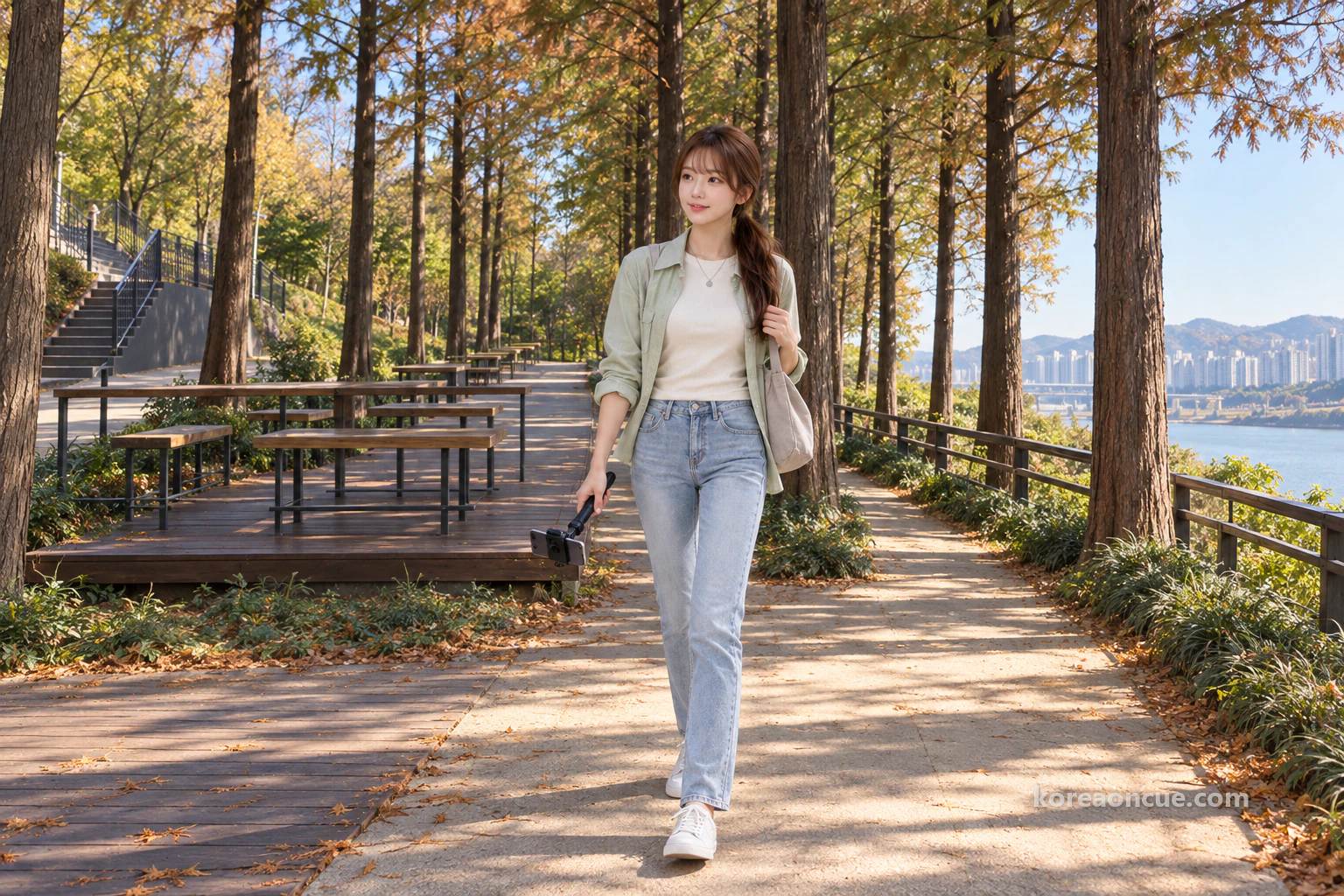
How to get there
On the day Seoul announced its 110 Autumn Foliage Paths, Lulu scrolled slowly through the article on the subway. Between the ginkgo path and the zelkova path, her finger stopped on one line: the World Cup Park Metasequoia Path, a 2.3 km walking path from Haneul Park to Noeul Park. Lulu was born and raised in Seoul, but she had never seen this path’s name before.
Lulu’s test for a good walk is simple. She prefers a place you only understand by walking it to one that ends with a single photo. It matters even more because she films. A view that fits in one shot is already finished on the phone screen, but a path that changes with every step only becomes a video once you walk it. The figure 2.3 km sounded to Lulu like that second kind of path.

Let’s start with the article’s numbers. Seoul’s 110 Autumn Foliage Paths add up to 167 km, counting everything from parks to promenades. Many kinds of tree, including ginkgo, zelkova, Yoshino cherry and metasequoia, make up the autumn scenery along those paths. The World Cup Park Metasequoia Path was one of the 110 paths on this year’s list. It is a list that introduces autumn paths all over Seoul at once, so each path’s details were given only briefly.
The picture that came to Lulu first that day was this: a path that starts at the top of Haneul Park, follows the ridge and reaches the top of Noeul Park, with metasequoia trees standing in rows on both sides. The two parks are close together and famous for silver grass and for sunsets, so it seemed a plausible picture. But Lulu is someone who looks at the map first whenever she sends friends a route. So before going out to film, she searched for the path’s name and opened the location map in the article Seoul published in May about the path’s opening.
This piece follows the day Lulu walked alone on a weekday afternoon in November, after reading that map. She goes from Exit 1 of World Cup Stadium Station to the park, walks the Haneul Park side and then the Noeul Park side, and finally sorts out where the path starts and ends. This piece also covers the park’s closing time, the Maengkkongi electric shuttle times and where you have to climb stairs. If you read about the 110 Autumn Foliage Paths and came looking for this path, here is the most confusing part cleared up first.
The Cue — At a glance
The World Cup Park Metasequoia Path is 2.3 km in total, the Haneul Park side and the Noeul Park side together. The 1.0 km on the Noeul Park side opened on 22 May 2026. In November the park opens at 06:00 and closes at 21:00, and entry is controlled after 21:00. From Exit 1 of World Cup Stadium Station on Line 6, it is about 10 minutes on foot to the park entrance. Both paths lie on the southern foot of the hills, on the Nanji Hangang Park side, not over the summits.
- Where: the World Cup Park Metasequoia Path — the Haneul Park side plus the 1.0 km on the Noeul Park side, 2.3 km in all. Park address: 243-60 World Cup-ro, Mapo-gu, Seoul.
- Subway: Line 6, World Cup Stadium Station Exit 1, about 10 minutes on foot to World Cup Park (measured to the park entrance).
- Opening hours: November 06:00–21:00. No entry after 21:00, to protect wildlife.
- Maengkkongi electric shuttle: Route 1 (top of Haneul Park) 09:00–19:00, Route 2 (top of Noeul Park) 08:00–19:00. The last Route 1 ride up leaves 30 minutes before service ends. Route 2 runs every 30 minutes, and the general fare on Route 2 is 2,000 won one way.
- Shape of the path: on the Noeul Park side the start and end sections are deck paths, and the main part is a paved walkway.
- What you will see: rows of metasequoia, shelter decks, and the lookout spaces on the Haneul Park and Noeul Park sides.
- Names: the Seoul press release says “메타세쿼이아길”, and the park map says “메타세콰이어길”.
- Rules: no food allowed in (to protect wildlife), take your rubbish home, and please avoid bringing pets.
- Getting here: public transport is recommended.
How late can you walk on a November weekday afternoon — the park closes at 21:00
World Cup Park opens at 06:00 and closes at 21:00 in November. That closing time was also the first thing Lulu checked, before the location map. If you walk in the daytime, time is hardly a worry, but November days are short, so if you plan to start late in the afternoon it is worth remembering when the park closes. At the top of the notes app on her phone, Lulu wrote “06–21 / no entry at night”.
Open in Kakao Map — World Cup Stadium Station
The reason you cannot enter after 21:00 was interesting too. World Cup Park is an ecological park that brought Nanjido, once an island of rubbish, back to life, and at night it controls entry to protect living species. You cannot enter outside opening hours, so in November you cannot stay in the park after 21:00. Lulu planned her day so that she would be out before 21:00. So she settled on filming one video as she walked in the daytime.
She also noted down the timing of autumn colour in Seoul. This year’s autumn colour in Seoul is expected to peak from late October to early or mid-November. That forecast covers Seoul as a whole. Going by the city-wide forecast, Lulu picked a weekday in early to mid-November. She chose a weekday because she wanted to film the path slowly.
She wrote a line each about food and rubbish too. To protect wildlife, the park does not allow food in and asks visitors to take their rubbish home. It also asks visitors to avoid bringing pets, for the sake of the ecosystem and other visitors. Lulu had meant to pack snacks, but decided on a single bottle of water in her bag. The plan shrank to a simple one: have lunch, film one video, and head back.

Open the location map first — 2.3 km is the sum of two paths, not one line
2.3 km is the paths along the southern foot of the two parks added together. Before opening the location map, Lulu read the World Cup Park entry on Seoul’s autumn foliage path page. The entry listed metasequoia, silver grass and zelkova as the trees, and said you can enjoy the autumn atmosphere in the silver grass fields of Haneul Park and in Peace Park, which is beautiful with autumn colour. But neither the figure 2.3 km nor the name Metasequoia Path was in this entry. The two appear only in the press release about the 110 Autumn Foliage Paths. So Lulu concluded that the list page tells you only as far as the big neighbourhood, World Cup Park.
Around lunchtime Lulu boarded the Line 6 train and zoomed in on the project-section location map from the May article. This is where her first picture turned upside down. From their outlines, Haneul Park and Noeul Park sit side by side as two masses, with the Han River flowing to their south. The two paths, drawn as a dotted line and a thick line, did not lie along the tops of the two masses. They lay along the southern edge, on the foot of the hills facing the Han River.
The legend read as follows: “Noeul Park Meta Path (new)” is the dotted line and “Haneul Park Meta Path” is the thick line. The Haneul Park side was already a well-known spot, and the new 1.0 km on the Noeul Park side was joined to it to make 2.3 km in total. Lulu smiled a little as she read this line. Instead of the one-line ridge path she had imagined, it was one name given to two paths joined together.
She read about what kind of place World Cup Park is at the same time. The park was made by stabilising Nanjido, which was used as a landfill from 1978 to 1993, and turning it into an ecological space. It is made up of four parks: Peace Park, Haneul Park, Noeul Park and Nanjicheon Park, and it opened on 1 May 2002. The themes of the parks differ: Haneul Park is known for its grassland and silver grass views that seem to touch the sky, and Noeul Park for its sunset views blending with the Han River. Learning that there were four such different places in one park, Lulu first looked for which two of them the Metasequoia Path lay between.
The story of the Noeul Park side caught her eye in particular. This path had been closed until now, and opened on 22 May 2026. The path was made to link Haneul Park and Noeul Park better. It is November now, so the path has been open for less than six months. In her notes Lulu wrote “Noeul side 1.0 km — opened 22 May”.

So where does this path go from and to? The Z-shaped stairs on the south side of Haneul Park were built in November 2025. Thanks to them, the route from Nanji Hangang Park through the Noeul Park and Haneul Park Metasequoia Paths up to the top of Haneul Park has become smoother. On the location map, both paths lie on the southern foot on the Nanji Hangang Park side, and one south Z-shaped staircase is marked about halfway along each path. In short, the paths lie along the foot of the hills, and the summit is a separate climb by stairs.
Lulu put this structure into one line in her notes. After writing “Path = foot / summit = stairs, separately”, her head felt much clearer. Had she gone believing it was a path joining the summits, she would have spent a long time hunting for it at the top. If you do not know where the path is, the time it takes to walk and the places where you need your strength both change. Lulu decided to send this one line to her friends before the video.
From Exit 1 of World Cup Stadium Station to the park — about 10 minutes on foot
From Exit 1 of World Cup Stadium Station it is about 10 minutes on foot to the entrance of World Cup Park. Getting off at World Cup Stadium Station on Line 6, Lulu went up to Exit 1 too. This 10 minutes is the time to the park entrance. The entrance to the Metasequoia Path is inside the park, so you have to walk further after you enter. So before getting off the train, Lulu set aside plenty of separate time for walking and filming inside the park.
It helps to open the park map once before you walk. Lulu had page two of the map leaflet from the park’s website open on her phone. On the map, the western end is Noeul Park, Haneul Park is in the middle, and Peace Park and World Cup Stadium Station lie to the east. Lulu pictured in her head that the subway station is at the eastern end.
The map also showed a way to find the Haneul Park side of the path. Number 19 in the legend is “메타세콰이어길”, drawn as a line of trees along the lower edge of Haneul Park. The Seoul press release writes “메타세쿼이아길” while the park map writes “메타세콰이어길”, so the different names may make you wonder if they are different paths. They are two spellings of the same tree name, so you need not be thrown if you see “메타세콰이어길” on the park map. Lulu noted this difference in the name on a corner of her notes.

The Haneul Park side — walk between two rows of trees and rest on the shelter deck
The Haneul Park side is a paved walkway running between two rows of metasequoia. Stepping onto it, Lulu lowered her phone gimbal to knee height, as she always does. She has a habit of filming a new path from the ground up, because she thinks the first thing a walker meets is what is underfoot. From each straight trunk, thin branches hung in a fine layer over the path, and because the ground is paved, her steps came evenly.
In autumn this path becomes a tunnel of red leaves, and that word “tunnel” settled Lulu’s camera framing. If it is a tunnel, she only has to put the point where the two rows of trees meet at the end of the path, and shoot so that trunks and branches narrow in from both sides. From the middle of the path she shot once facing forward, and from the edge once looking up at the trunks. She captured the same spot twice.
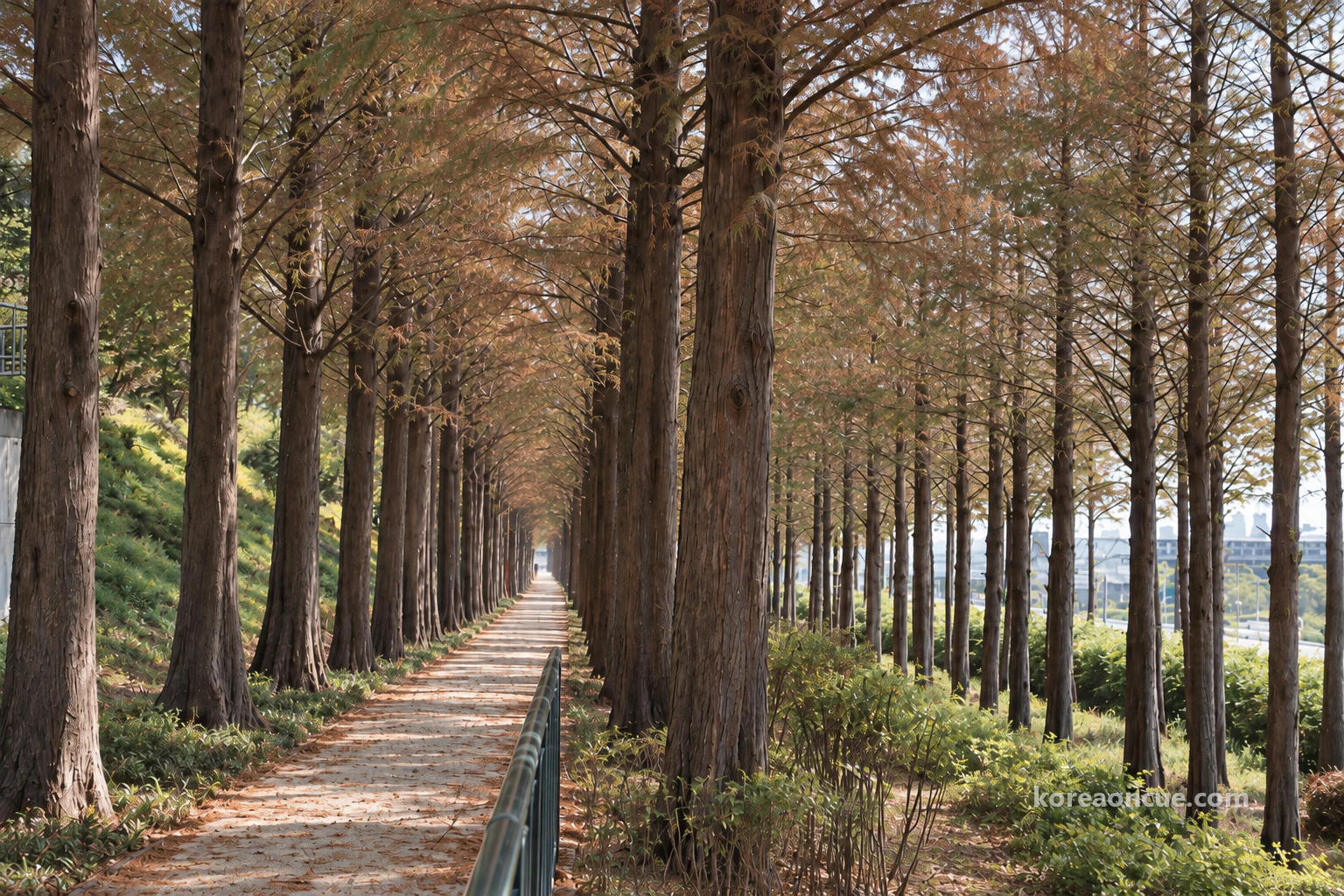
She split the shooting order into three, to suit the shape of the path. First, low shots of the ground underfoot. Next, tilting the camera up along the trunks. Last, the end of the path where the two rows meet. If you capture only one thing at a time, it is easy to change the order when editing. Lulu believed this method suits a long path best. The more a path refuses to fit in a single shot, the easier editing becomes if you have divided the shots into three.
There are places to rest along the path. Gardens have been made at ten main entry routes on the paths linking Haneul Park and Noeul Park, and four of them have shelters. They are spots for walkers and runners to rest for a while. The shelter Lulu came to had table-like wooden benches on a timber deck, and right beside it a zigzag wooden staircase climbed upward.
Sitting on a bench, Lulu took a sip of water and skimmed through the footage she had just shot. A video of only the path is pretty, but it bothered her that a friend watching would not know how far the path goes. So she changed the order. At the very start of the video she would put a capture of the location map, followed by the ground underfoot and the two rows of trees stitched together. A structure that starts on the ground and rises upward suits this path, Lulu thought.
It also puts your mind at ease to know the facilities before you walk. Haneul Park has a visitor information centre, five toilets and four drinking fountains. It is a park that bars food and asks you to take your rubbish home. So Lulu had brought only a bottle of water and a small plastic bag. She put the empty bottle and tissues into the plastic bag and kept them in her bag until she got back.

Take the stairs separately — the summit lookout is up the Z-shaped stairs
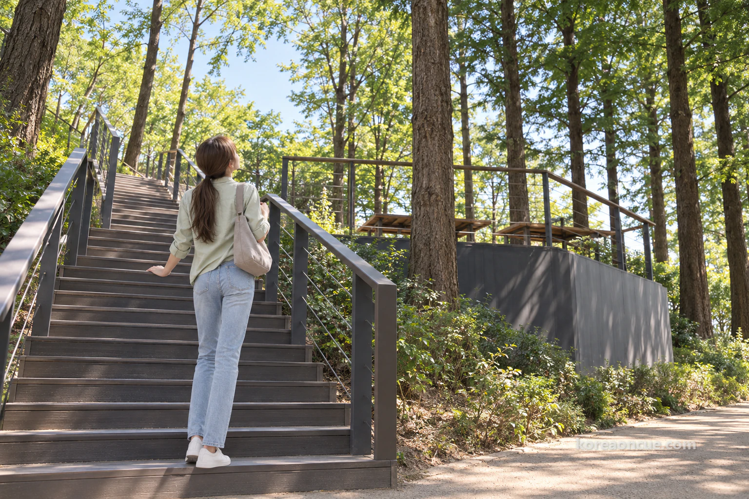
You reach the top of Haneul Park from the path by a separate climb, up the south Z-shaped stairs. The zigzag staircase next to the shelter was that very staircase marked on the location map. The Haneul Park side of the path lies along the foot, and the summit is at the top of the stairs. At the summits of Haneul Park and Noeul Park there are four lookout spaces, newly built or renovated. From the Haneul Park lookout you can see the Han River skyline, running past World Cup Bridge and Seongsan Bridge and Seonyudo as far as Yeouido.
Places to rest have also increased at the top. Part of a closed middle road has been opened and landscaped, adding two more rest areas. Together with the four summit lookouts, there are several places up there where you can sit down and look at the Han River as you walk. Reading this, Lulu thought that on a day you climb the stairs, it is best to leave some slack in the schedule. Only if you plan in the time to rest at the top of the stairs can you film without rushing.
At the bottom of the stairs, Lulu raised her head and looked up at the wooden deck above. Today’s star was the path, so she decided to leave the climb to the summit for another time. Another caster had already written at length about the summit, from the silver grass fields to the observation deck, in the Haneul Park episode, too. Instead, she put one shot looking up from the foot of the stairs into the video, so that her friends could see on screen that the summit is separate, above the path.
To sum up the summit briefly: the silver grass on Haneul Park is not cut until spring. Silver grass that used to be cut all at once around November is, from 2026, cut in March to May instead, before the new shoots come up. In winter the silver grass becomes another view, dried to gold, and it also gives migratory birds food and a place to rest. If you feel like seeing the silver grass fields at the top, you can climb by the south stairs or on Maengkkongi electric shuttle Route 1.
The Noeul Park side — the 1.0 km that opened in May, with deck paths at the start and end
The Noeul Park side is the 1.0 km that newly opened in May, with deck paths at its start and end points. Having walked the Haneul Park side once, Lulu headed on to the Noeul Park side. The deck paths were laid to make the path easy to step onto, and the main part of the path is a paved walkway. This is a point that may feel a little different if you come thinking the whole path is boards, because of the press release’s word “deck path”.
What caught her eye first on the Noeul Park side was the seats. Along the leafy path, resting seats are set out here and there. They are there so you can rest in cool shade in summer and take in the autumn colour in autumn. Lulu sat on one and put her bag down. Having walked the path in two parts, she felt for certain that the Haneul Park side she had just walked and this one are two sides of a single name.
Sitting on the seat, Lulu thought of her cousin, who goes about with a child. This walkway was made so that people of all ages can enjoy the atmosphere of autumn without difficulty in walking. The deck paths at the start and end on the Noeul Park side were also made to be easy to step onto. Lulu took a few more photos so that she could explain the surface and slope of the path to her cousin herself.

Beside the seat, Lulu remembered the location map again. On the map, a south Z-shaped staircase is also drawn halfway along the Noeul Park side of the path, and above that staircase is the summit lookout space. If Maya, who takes photographs, heard this, Lulu was sure she would stand there longest. But today’s goal was to turn one path into a video, so she only took in the Noeul Park side’s lookout space from the foot of the stairs.
There is one more thing to know about the Noeul Park side. Noeul Park is a cultural and art park where you can see the most beautiful evening sunsets in Seoul, and it is also a treasure house of ecology, home to water deer, leopard cats and raccoon dogs. These animals are the reason the park bans food and controls entry at night. Lulu decided to film the sunset another time, separately, and on this path she captured only the trees and the path.
Here is a short note on how Noeul Park became what it is now. Noeul Park was built on about 340,000 m² of Nanjido Landfill No. 1. At first around 57% of the total area was made into a golf course. On 17 June 2008 Seoul decided to turn the golf course into a family park, and reopened it as a park on 1 November the same year. On 26 July 2009 the sculpture park also opened.
The notes also had a story about the trees on this foot of the hill. On the southern slope of World Cup Park there is a plan to clear out alien plants such as bur cucumber and plant trees with beautiful flowers and autumn colour, such as Yoshino cherry, fringe tree, Korean maple and azalea. The southern foot, where the Metasequoia Path lies, is the stage for this project. Lulu decided to put the plan to plant Yoshino cherry, Korean maple and other trees on the southern slope into her video description. She thought it would be good for her friends to know which trees will fill the slope beside the path in the years ahead.

When your legs tire, take the Maengkkongi electric shuttle — Route 1 and Route 2 run on different hours
Route 1 and Route 2 of the Maengkkongi electric shuttle run on different hours in November. For days when the walk goes long and the legs grow heavy, Lulu also found out about this shuttle. From the Nanjicheon Park car park, shuttles leave for the top of Haneul Park (Route 1) and the top of Noeul Park (Route 2). Route 1 runs from 09:00 to 19:00 in November. Route 2 runs from 08:00 to 19:00.
The intervals differ by route too. On Route 2 a vehicle comes every 30 minutes, while Route 1 runs frequently or every 10–20 minutes. The last Route 1 ride up leaves 30 minutes before service ends, so if you want to go up to the summit in the late afternoon, you need to think about the time earlier. The general fare on Route 2 is 2,000 won one way, and 1,500 won one way for a child. People aged 65 and over and disabled visitors pay 1,500 won one way, and children aged 48 months and under ride free.
Route 1 and Route 2 both run from the Nanjicheon Park car park to a summit. So it is convenient to divide the two: if you want to see the summit lookout without walking the whole path, take the shuttle, and if you want to walk the metasequoia path on the foot of the hill, use your own two feet. Lulu wrote down in one line that the two ways of getting around have different uses.
The Nanjicheon Park car park has 438 spaces and is also where you board the Maengkkongi electric shuttle. Even though there is a car park, the park asks visitors to use public transport. Lulu came by subway, so she did not take the shuttle this time. She noted that she would ride it once the next time she went up to the summit, and wrote the fare and times beside it.
The location map sent to friends, and Ethan’s question about numbers
Before leaving the park, Lulu finished the video on a bench. First came the location map capture, then the two rows of trees on the Haneul Park side, then the shelter stairs and the deck path on the Noeul Park side. She put in only two lines of subtitles. One was “2.3 = Noeul 1.0 + Haneul side” and the other was “Foot, not summit”.
That evening at home she played the video again from the start. With the location map capture at the front, a viewer could picture the path before it began. She put no subtitle on the shot of the ground underfoot and left only the sound of walking. She held the last shot, where the two rows of trees meet, for a long time, so that it feels as if the path goes on even after the video ends.

When she posted the video in the four-person chat room, replies came quickly. On the first screen, with the location map capture, Maya sent “Is this the map? I thought it was up on the hill, but it’s down below”. It seemed Maya had pictured a ridge path, just as Lulu had. Rina wrote briefly in polite speech, “Showing the location map first is a good order, I’ll make a note of it too”, and posted a photo of her notebook. The heading in it was “World Cup Park — foot / summit”.
Ethan’s reply was, as usual, a drawing. He posted a simple line drawing based on the location map: two thick lines joined along the bottom, with one Z-shaped mark in the middle of each line. Under the drawing was a single line, “Two lines, two staircases, right?” Lulu answered “Yes, that’s right! The summit is separate, up above.” She decided to attach the line drawing Ethan made after the last scene of the video.

Back home, Lulu opened the last page of her notes and sorted the day’s order. Under “Location map → Haneul side → foot of the stairs → Noeul side → video”, she added one line: “Foot, not summit — the sum of two paths”. The ridge path she first imagined had been wrong, but she liked that finding out it was wrong was what settled the order of the video. Lulu decided that next time she would film the stairs up to the summit and the sunset as a separate piece, and switched off the light.
Common Mistakes
Thinking 2.3 km is a ridge path joining the summits
both paths lie on the southern foot, on the Nanji Hangang Park side. You climb to the summit separately, by the Z-shaped stairs.
Thinking the whole Noeul Park side is a deck
there are deck paths at the start and the end. The main part of the path is a paved walkway.
Dropping by after 21:00
in November the park closes at 21:00, and entry is controlled after that.
Assuming the shuttle times are the same on Route 1 and Route 2
Route 1 runs 09:00–19:00 and Route 2 runs 08:00–19:00. The intervals differ too.
Taking 10 minutes to be the time from the station to the path entrance
the 10 minutes is from World Cup Stadium Station Exit 1 to the park.
Taking “메타세콰이어길” on the park map to be a different path
it is the same tree name written another way, and the same path as the Metasequoia Path in the Seoul press release.
FAQ
How many km is the whole Metasequoia Path?
It is 2.3 km, the Haneul Park side and the Noeul Park side together. Of this, the Noeul Park side is 1.0 km.
When did the Noeul Park side open?
It opened on 22 May 2026.
Which station and exit do I use?
From Exit 1 of World Cup Stadium Station on Line 6, it is about 10 minutes on foot to World Cup Park.
Until what time can I enter in November?
The park opens at 06:00 and closes at 21:00. Entry is controlled after 21:00.
When does the Maengkkongi electric shuttle run?
Route 1 runs 09:00–19:00 and Route 2 runs 08:00–19:00. The last Route 1 ride up leaves 30 minutes before service ends. Route 2 runs every 30 minutes, and the general fare is 2,000 won one way.
Can I take food in?
Food is banned, to protect wildlife.
How long does the silver grass stay?
It stays until spring. The Western Park Leisure Centre has pushed the cutting season back to around March to May from 2026.
Recap — 30 seconds before you go
- Line 6 World Cup Stadium Station Exit 1 → about 10 minutes on foot → World Cup Park
- World Cup Park Metasequoia Path = Haneul Park side + 1.0 km on the Noeul Park side, 2.3 km in all
- Both paths lie on the southern foot on the Nanji Hangang Park side, not over the summits — the summit is a separate climb by Z-shaped stairs
- November park hours 06:00–21:00, no entry after 21:00
- Maengkkongi electric shuttle Route 1 09:00–19:00 · Route 2 08:00–19:00 (every 30 minutes, general fare 2,000 won one way)
Sources
- Seoul Metropolitan Government press release — selection of the “110 Seoul Autumn Foliage Paths” (30 October 2026)167 km in total · ginkgo, zelkova, Yoshino cherry, metasequoia and other trees · the 2.3 km World Cup Park Metasequoia Path from Haneul Park to Noeul Park · Seoul’s autumn colour expected to be at its best from late October to early or mid-Novemberchecked 2026-10-31
- Seoul website — guide to the 110 Seoul Autumn Foliage PathsWorld Cup Park entry: trees listed as metasequoia, silver grass and zelkova, with the line that autumn can be enjoyed at the Haneul Park silver-grass field and Peace Park · contact 02-300-5545checked 2026-10-31
- Seoul in My Hands — the Noeul Park Metasequoia Path opens (20 May 2026)The new 1.0 km on the Noeul Park side plus the Haneul Park side make 2.3 km · the project-section location map (bold line for the Haneul Park side, dotted line for the Noeul Park side, along the foot of the slope by Nanji Hangang Park) · deck paths at the start and end · rest seats · southern Z-shaped staircase · summit viewing areas and rest areas · opened on 22 Maychecked 2026-10-31
- Parks of Seoul — World Cup ParkNovember 06:00–21:00 · closed to entry at night · no food, take rubbish home, please refrain from bringing pets · Maengkkongi electric shuttle Route 1 09:00–19:00, Route 2 08:00–19:00 (every 30 minutes, adult single 2,000 won) · Haneul Park facilities · Nanjicheon Park car park, 438 spaceschecked 2026-10-31
- World Cup Park leaflet — Park mapTransport: Line 6 World Cup Stadium Station Exit 1, about 10 minutes on foot · park address 243-60 World Cup-ro, Mapo-gu · key number 19 on the map: “Metasequoia Path” (Metasequoia spelled the park’s way)checked 2026-10-31
- Seoul environment website — Haneul Park silver grass kept until early spring (15 January 2026)Western Parks Leisure Center policy: silver grass previously cut around November will be cut around March to May from 2026checked 2026-10-31
A Seoul story told with our AI characters. Place details are checked against public sources; the photos are AI-made illustrative images. How we use AI
More from this area

Oil Tank Culture Park: what to see instead of the shut tanks
Mali gets off at World Cup Stadium Station to see the light inside a round tank from a blog post written a few years ago.

Gyeongui Line Forest Park: ginkgo path and old tracks
Back in Seoul after a month, Mali messages Rina: “I’d like to see some autumn colours.” Rina chooses an old railway route that starts at a single pine tree outside Hongik University Station Exit 3.